He’s got a launch party planned here at Guelph. Now Aaron Berg is crossing his fingers for successful deployment of a NASA satellite this week.
All going well, the U of G geography professor expects he’ll begin receiving data from the Soil Moisture Active Passive (SMAP) satellite this spring. He says information from the satellite about global soil moisture and soil freeze-thaw stats will help forecasters and farmers better predict floods, droughts, seasonal weather forecasts and crop yields.
An expert in soil moisture and modelling, Berg will be among a group of leading Canadian and international researchers to receive and analyze data from the new satellite.
But why is soil water so important?
Weather can be affected by how much water evaporates into the atmosphere, says Berg, and a key influence on that evaporation rate is how wet or dry soils are. Soil moisture also affects flooding or drought. Farmers need to consider soil conditions before planting or spraying crops.
The new satellite is scheduled to be launched Jan. 29. Berg will speak about the project and provide a live feed of the launch in the Hutt Building, 240B, beginning at 9 a.m.
Orbiting from pole to pole some 700 kilometres above Earth, the satellite will use both microwaves and radar to monitor soil wetness. The satellite sensors will essentially “paint” longitudinal swaths of the planet, covering all of Canada every two to three days, says Berg.
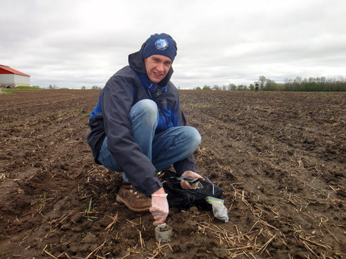
Back on Earth, researchers will compare and validate the satellite measurements with information from ground-based sensors at monitoring sites in Ontario, Manitoba, Saskatchewan and the Northwest Territories. Along with his students and post-doc researchers, Berg monitored these sites for several years while the new satellite was being developed.
Along with researchers from other Canadian universities, Berg belongs to the Floodnet Network, which is improving flood prediction. The network received federal government support last fall. He plans to look at how soil moisture data can be used in flood prediction models.
Because the sensors can distinguish between wet and frozen ground, they will also help researchers learn more about freeze-thaw cycles, particularly in Canada’s vast tundra lands.
Berg says his research team is among few academic centres with observation networks able to validate soil moisture and freeze-thaw cycles from various satellite sensors. All of his nearly dozen students and post-docs have projects using satellite-based soil moisture observations, with study sites ranging from southern Ontario farmland to the boreal forest to the tundra.
Partners on the Canadian science team for the SMAP satellite include the Canadian Space Agency, Agri-Food and Agriculture Canada, and Environment Canada, as well as researchers at the University of Sherbrooke, the University of Toronto and the University of Manitoba.