It sounds a little like science fiction: a satellite circling the Earth that can detect the moisture content of the soil as it passes over, creating data sets that can be used to predict weather, floods, droughts and crop yields. But there’s no fiction to this story: that satellite will be launched by NASA in 2014. And research done by U of G geography professor Aaron Berg will ensure the data sent back is accurate and useful.
“A great deal of my research program is focused on soil moisture and how it helps with forecasting,” Berg says. “For example, when soil moisture is included as a factor in weather climate models, we can more accurately predict seasonal temperature ranges one month or two months into the future.” To use soil moisture data, though, it’s essential to have accurate information over large areas.
Enter NASA. In partnership with the Canadian Space Agency, the U.S. agency is working with a team of Canadian scientists that includes Berg and other researchers from the University of Manitoba, the University of Sherbrooke, Environment Canada, Agriculture and Agrifood Canada, and several researchers from American universities and government agencies. These researchers will test and validate the sensors that will be placed on the future satellite.
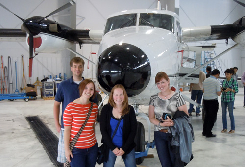
Here’s what they’re doing: Berg and six of his group members, including students and postdoctoral associates, have been working near Winnipeg, where NASA has aircraft with the sensors installed. He says the students do “most of the heavy lifting,” and by that he means that they go out into specific fields every two days for six weeks to measure the moisture in the soil. Some areas are heavily forested and some have dense crop cover; others are more open. The moisture variations across each of the fields are tracked meticulously.
At the same time, the sensor-equipped planes fly over the terrain and collect data in two ways. One is active: microwaves are sent towards the ground and the returning signal is recorded. The other is passive: the radiation naturally emitted by the Earth is also tracked. Hence the name of the project: Soil Moisture Active-Passive or SMAP.
“Combining the data from both sources gives you a more detailed look at the soil,” explains Berg. “Basically, at these frequencies soil is brighter when it is dry and darker when it is wet.” By measuring the degree of brightness recorded and comparing it to the soil moisture data from the students working on the ground, they can calibrate the sensors to give useful soil moisture information. Trees, crops and other objects on the land can complicate the brightness detected by the sensors, so those need to be accounted for as well.
“It’s worth the work to get this right, though, because soil moisture is such an important variable,” says Berg. “When it’s right, the information may be useful on the farm level, helping individual farmers to make decisions about crop management and pest control, but also on the national level where it helps with flooding, weather, seasonal climate prediction and other applications on the larger scale.”
For Berg, this project combines many of his favourite aspects of research. “I like being out in the field and working with students, and I also like the analytical side, working with the data.” Another bonus is working with a network of other expert researchers across North America.
While Berg has enjoyed his involvement in validating the satellite’s sensors, he’s also excited about the research possibilities in the data that will come from the satellite once it begins its mission. “A lot of really amazing projects should come from this,” he says. While the official length of the satellite’s mission is three years, Berg is hoping it will be in orbit longer. “The last satellite that we used for soil moisture observation had less-than-optimal sensors, but it flew from 2002 to 2011. I’m hoping we’ll get five to 10 years from this one, too.”
NASA scientists have been blogging about their field experiences in Manitoba at http://smap.jpl.nasa.gov/blogs/.