

By Dr. Md Bodruddoza, postdoctoral researcher and Dr. Wanhong Yang, professor, in the Department of Geography, Environment and Geomatics in the College of Social and Applied Human Sciences at the University of Guelph.
This article is republished from The Conversation Canada under a Creative Comms licence. Read the original article here.
Anyone living along the coast of Lake Erie will be well aware of the periodic algal blooms that appear on its surface. The greenish blooms can cause rashes and other health problems and pose risks to both humans and animals.

In 2016, Canada and the United States agreed to reduce the amount of phosphorus entering Lake Erie’s western and central basins by 40 per cent of 2008 levels. Yet recent reporting shows that this target remains largely unmet.
Excess nutrients, especially phosphorus and nitrogen, can increase harmful algal blooms in lakes. These blooms deplete oxygen levels in the water, threatening drinking water, fisheries and communities that rely on tourism.
Algal blooms in Lake Erie also remind us how closely food production and clean water are connected. Many of these nutrients come from nearby farms, and the challenge is keeping them out of waterways. Agricultural water pollution is not like pollution from a single pipe: it comes from many fields and moves through different pathways.
Some of these excess nutrients come from nearby farm fields. They travel overland during storms or in snowmelt, or move underground through drain tiles — buried pipes that remove excess water from wet soil.
In 2025, we studied the area around Medway Creek, a tile-drained agricultural watershed in southwestern Ontario. We observed the fields, terrain, soil, crop history and drainage information and used a mapping tool to identify potential locations for conservation practices.
Fields with higher conservation needs generally had stronger connections to water pathways, featuring steeper slopes and more vulnerable soils. Protecting Lake Erie requires using different kinds of conservation practices in different fields and areas where they are most likely to work.
Our research
Agricultural conservation programs offer several options to manage water quality. These include using wetlands, grassed waterways, water and sediment control basins, controlled drainage and riparian buffers — a strip of permanent vegetation next to a waterway — among other measures. But more options do not necessarily lead to better decisions. Limited land, money and time mean that these options cannot all be used everywhere.

The key question is figuring out which approach to use in which fields. This is the basis of precision conservation: using data, field knowledge, watershed models and local experience to match conservation actions to the places where they will be most effective in reducing nutrient and sediment losses.
We surveyed 138 agricultural fields and assessed conservation needs based on signs such as erosion, ponding, poor drainage, concentrated flow and riparian degradation. Machine-learning models extended that assessment across the watershed and identified high-priority fields for conservation planning. However, a high conservation-need ranking does not prove that these fields produce the most nutrient pollution. Instead, it provides a starting point for further assessment.
We then used watershed modelling to examine where nutrient and sediment losses were concentrated and how they moved through the landscape. Our modelling suggested that phosphorus-related losses were concentrated in a small group of fields, while nitrogen-related losses were spread more widely. Different forms of nutrient pollution may therefore require different conservation strategies.
If nutrients runoff over land, solutions could include grassed waterways or water and sediment control basins. Tile-drained fields may suit controlled drainage, denitrifying bioreactors or phosphorus filters. Streamside fields may require riparian restoration. Some fields may need more than one approach.
In another study, we developed a framework that ranked approaches for each field using conservation need, landscape suitability and stakeholder priorities.
Farmers need support
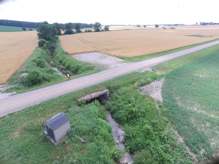
In Medway Creek, controlled drainage was the top-ranked practice, while the suitability of other practices varied with soil, slope, drainage, nutrient pathways and local priorities. Existing conservation practices were already benefiting water quality.
We used watershed modelling to test individual and combined multi-layered conservation strategies that could be implemented in the field, edge-of-field and watershed scales.
Combining additional tile-drainage management, nutrient incorporation and tillage changes could achieve a balanced reduction in nitrogen and phosphorus in 47 per cent of the modelled agricultural fields. However, some conservation strategies still produced limited results in reducing how nutrient runoff depending on local field conditions.
The lesson is that some practices will work differently depending on the pollutant, pathway and area. An approach that stops nutrients seeping out of one field may be less effective in another.
Farmers face economic and practical constraints because conservation practices often require money, time and maintenance. Better targeting can help farmers and conservation authorities direct limited resources towards suitable places and practices.
However, targeting does not replace local knowledge, engineering design, cost assessment or field verification. A conservation map should help the right people ask better questions.
Addressing Lake Erie’s algal blooms will require more informed conservation planning: identifying where nutrient losses occur, understanding how they reach waterways, matching practices to those pathways and evaluating whether they actually work.
Collaboration among farmers, researchers, conservation authorities and government agencies can help turn conservation plans into practical measures that farmers can adopt to help keep waters healthy.